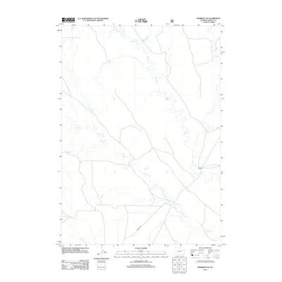
2012 Map of Morrisey NE
USGS Topo · Published 2012About this map
Beaver Cr and its numerous tributaries dominate this arid landscape in Weston County. The drainage network, including Mush Cr, S Beaver Cr, and Rough Cr, defines the topography of this high plains region. Human presence is sparse, centered primarily around ranching operations like the M Bar Ranch and the connective corridor of Morrissey Rd. The inclusion of Oil Cr in the northeastern corner hints at the local resource extraction that has long shaped the regional economy. This survey documents the area's rural character during the early 21st century, illustrating a land still defined by its watercourses and isolated ranching outposts.
Find a feature on this map
7 named features on this map. Tap any name to fly to it.
Don’t see what you’re looking for? This feature index may not catch every label — zoom into the map to look around manually.
Map Details
Editions of this 2012 Morrisey NE Map
This is the sole edition of this map. No revisions or reprints were ever made.
Other maps of this area

1899 · Newcastle
USGS Topo · 1:125,000

1901 · Newcastle
USGS Topo · 1:125,000

1951 · Owens
USGS Topo · 1:24,000

1951 · Dewey SW
USGS Topo · 1:24,000

1951 · Newcastle
USGS Topo · 1:24,000

1951 · Morrisey NE
USGS Topo · 1:24,000

1951 · Osage SE
USGS Topo · 1:24,000

1955 · Newcastle
USGS Topo · 1:250,000

1958 · Newcastle
USGS Topo · 1:250,000
1958 · Newcastle
USGS Topo · 1:62,500