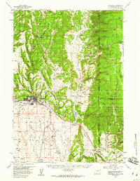
1958 Map of Newcastle
USGS Topo · Published 1960About this map
Newcastle serves as the focal point of this late 1950s survey, situated where the southern reaches of the Black Hills meet the high plains of eastern Wyoming. The landscape is defined by a transition from the wooded terrain of the Black Hills National Forest to the open flats of Antelope Table. A significant historical footprint is visible at Cambria (Site), once a major coal mining hub, evidenced here by the remaining Cambria Cem and the route of Cambria Creek. Transportation and industry drive the local geography, with the Burlington Chicago and Quincy railroad skirting the western edge of the highlands and a new highway noted as Under Construction south of town. Notable agricultural landmarks like the Flying V Ranch and LAK Ranch reflect the region's ranching heritage, while the Greenwood Chapel and Sweet Sch provide clear markers of the rural social infrastructure of the era.
Find a feature on this map
78 named features on this map. Tap any name to fly to it.
Don’t see what you’re looking for? This feature index may not catch every label — zoom into the map to look around manually.
Map Details
Editions of this 1958 Newcastle Map
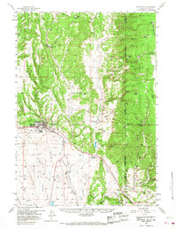
2 editions found
Other maps of this area

1894 · Deadwood
USGS Topo · 1:125,000

1896 · Harney Peak
USGS Topo · 1:125,000

1898 · Sundance
USGS Topo · 1:125,000

1899 · Newcastle
USGS Topo · 1:125,000

1901 · Harney Peak
USGS Topo · 1:125,000

1901 · Deadwood
USGS Topo · 1:125,000

1901 · Newcastle
USGS Topo · 1:125,000

1902 · Sundance
USGS Topo · 1:125,000

1916 · Deadwood
USGS Topo · 1:125,000

1951 · Owens
USGS Topo · 1:24,000