1958 Map of Newcastle
USGS Topo · Published 1968About this map
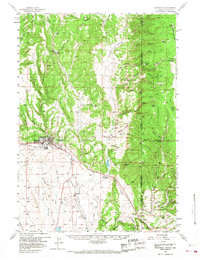
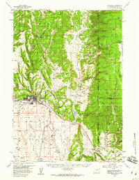
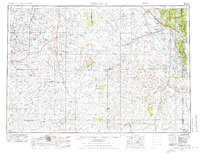
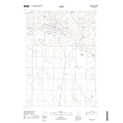
Newcastle serves as the focal point of this late 1950s survey, situated where the high plains meet the western edge of the Black Hills National Forest. The town's industrial and civic infrastructure is visible through labels for the Chicago Burlington and Quincy railroad, a Drive-in Theater, and the Fairground. To the north, the settlement of Cambria and the Cambria Cem highlight the area's mining and local history, while the ranching economy is represented by the Flying V Ranch and LAK BM Ranch.
Find a feature on this map
90 named features on this map. Tap any name to fly to it.
Don’t see what you’re looking for? This feature index may not catch every label — zoom into the map to look around manually.
Map Details
Editions of this 1958 Newcastle Map
2 editions found
Historical Maps of Newcastle Through Time
11 maps found

1899 Newcastle
Weston County, WY
1901 Newcastle
Weston County, WY
1951 Newcastle
Weston County, WY
1955 Newcastle
Weston County, WY

1958 Newcastle
Weston County, WY
1958 Newcastle
Weston County, WY
1979 Newcastle
Weston County, WY
2012 Newcastle
Weston County, WY
2015 Newcastle
Weston County, WY
2017 Newcastle
Weston County, WY
2021 Newcastle
Weston County, WY