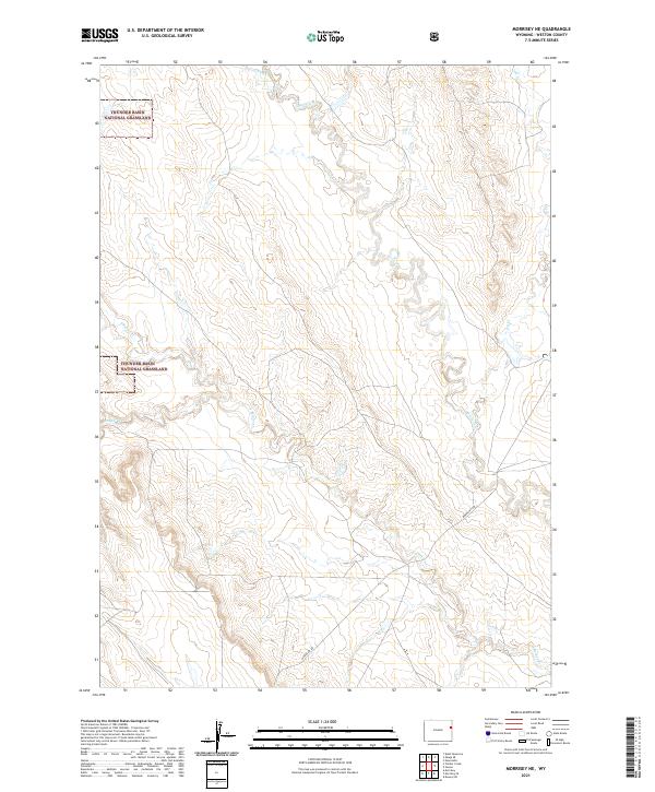
2021 Map of Morrisey NE
USGS Topo · Published 2021About this map
Thunder Basin National Grassland dominates the northwestern portion of this Weston County landscape, where the public rangelands meet a complex system of seasonal drainage basins. The area is defined by its hydraulic network, primarily the various branches of Beaver Cr, including S Beaver Cr and Oil Cr. These waterways carve through the high plains, creating a distinct topographical signature of draws and ridges.
Find a feature on this map
13 named features on this map. Tap any name to fly to it.
Don’t see what you’re looking for? This feature index may not catch every label — zoom into the map to look around manually.
Map Details
Editions of this 2021 Morrisey NE Map
This is the sole edition of this map. No revisions or reprints were ever made.
Other maps of this area

1899 · Newcastle
USGS Topo · 1:125,000

1901 · Newcastle
USGS Topo · 1:125,000

1951 · Owens
USGS Topo · 1:24,000

1951 · Dewey SW
USGS Topo · 1:24,000

1951 · Newcastle
USGS Topo · 1:24,000

1951 · Morrisey NE
USGS Topo · 1:24,000

1951 · Osage SE
USGS Topo · 1:24,000

1955 · Newcastle
USGS Topo · 1:250,000

1958 · Newcastle
USGS Topo · 1:250,000
1958 · Newcastle
USGS Topo · 1:62,500