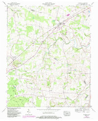
1956 Map of Morrison
USGS Topo · Published 1985About this map
Morrison and Summitville anchor the landscape on this mid-century survey, which details the rural crossroads of Warren and Coffee counties during a period of transition. The Seaboard railroad cuts a diagonal through the terrain, serving as a primary artery for the small communities and agricultural lands between the Tennessee Valley Divide and the surrounding highlands. This area is defined by a dense network of country churches and family burial grounds, such as Hickory Grove Church, Fountain Grove Ch, and the Stroud Cem, which reflect the established genealogical roots of the region.
Find a feature on this map
46 named features on this map. Tap any name to fly to it.
Don’t see what you’re looking for? This feature index may not catch every label — zoom into the map to look around manually.
Map Details
Editions of this 1956 Morrison Map
3 editions found
Other maps of this area

1893 · Mc Minnville
USGS Topo · 1:125,000

1895 · Mc Minnville
USGS Topo · 1:125,000

1895 · Sewanee
USGS Topo · 1:125,000

1913 · Hollow Springs
USGS Topo · 1:62,500

1936 · Fredonia
USGS Topo · 1:24,000

1936 · Manchester
USGS Topo · 1:24,000

1936 · Petty Gap
USGS Topo · 1:24,000

1936 · Morrison
USGS Topo · 1:24,000

1936 · Hillsboro
USGS Topo · 1:24,000

1936 · Cane Hollow
USGS Topo · 1:24,000