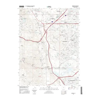
2016 Map of Morrison
USGS Topo · Published 2016About this map
Golden and the surrounding Front Range foothills are documented here during a period of significant suburban expansion and recreational development. The landscape is defined by the dramatic geological transition from the plains to the mountains, featuring the iconic Hogback and the paleontologically significant Dinosaur Ridge. Water management infrastructure is prominent throughout the area, from the Agricultural Ditch in the north to the Soda Lakes and Bear Creek Lake in the south. Several established burial grounds, including Golden Cem and Mount Vernon Cem, provide essential data for genealogical research. The map also shows the established community of Morrison at the mouth of Bear Creek Canyon, where the rugged terrain of Mt Morrison and Mt Glennon overlooks the evolving residential corridors of Lakewood and Dakota Ridge.
Find a feature on this map
287 named features on this map. Tap any name to fly to it.
Don’t see what you’re looking for? This feature index may not catch every label — zoom into the map to look around manually.
Map Details
Editions of this 2016 Morrison Map
This is the sole edition of this map. No revisions or reprints were ever made.
Other maps of this area

1899 · West Denver
USGS Topo · 1:125,000

1906 · Blackhawk
USGS Topo · 1:62,500

1938 · Morrison
USGS Topo · 1:24,000

1939 · Golden
USGS Topo · 1:24,000

1941 · Arvada
USGS Topo · 1:31,680

1941 · Fort Logan
USGS Topo · 1:31,680

1942 · Morrison
USGS Topo · 1:31,680

1942 · Golden
USGS Topo · 1:31,680

1942 · Littleton
USGS Topo · 1:31,680

1942 · Ralston Buttes
USGS Topo · 1:24,000