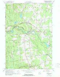
1966 Map of Morrisonville
USGS Topo · Published 1989About this map
The Saranac River carves a central path through Clinton County, anchoring the settlements of Morrisonville and Cadyville. This mid-century landscape is defined by the industrial and transport infrastructure of the era, from the hydroelectric powerplant at Kent Falls to the Delaware and Hudson Railroad corridor. The map reveals the distribution of ethnic enclaves such as the French Settlement in the northwest and the Irish Settlement along the Salmon River in the southeast, providing a clear view of the area's social geography. Local community life is rooted in landmarks like St Alexanders Ch and the County Fairgrounds, while the presence of the Plattsburgh Municipal Airport and Airborne Speedway points to the region's mid-century expansion and recreational development. Numerous gravel pits and the expanse of Clinton State Forest reflect the ongoing balance between resource extraction and land conservation.
Find a feature on this map
71 named features on this map. Tap any name to fly to it.
Don’t see what you’re looking for? This feature index may not catch every label — zoom into the map to look around manually.
Map Details
Editions of this 1966 Morrisonville Map
2 editions found
Other maps of this area

1894 · Plattsburg
USGS Topo · 1:62,500

1895 · Mooers
USGS Topo · 1:62,500

1895 · Rouse Point
USGS Topo · 1:62,500

1899 · Mooers
USGS Topo · 1:62,500

1906 · Plattsburg
USGS Topo · 1:62,500

1907 · Rouse Point
USGS Topo · 1:62,500

1913 · Dannemora
USGS Topo · 1:62,500

1939 · Rouses Point
USGS Topo · 1:62,500

1939 · Plattsburg
USGS Topo · 1:62,500

1941 · Plattsburg
USGS Topo · 1:62,500