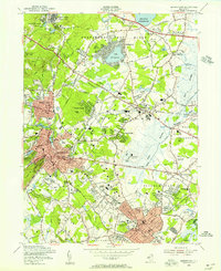
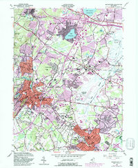
1954 Map of Morristown
USGS Topo · Published 1955About this map
The Washington Headquarters and the surrounding urban grid of Morristown anchor this 1954 snapshot of north-central New Jersey. This era represents a period of significant institutional footprint, with expansive campuses such as Greystone Park State Hospital, Drew University, and the College of St Elizabeth defining large tracts of the landscape between growing residential centers. The transportation network is a complex layering of older rail lines, including the Erie Railroad and the Delaware Lackawanna and Western Railroad, alongside developing suburban corridors like Columbia Road.
Find a feature on this map
107 named features on this map. Tap any name to fly to it.
Don’t see what you’re looking for? This feature index may not catch every label — zoom into the map to look around manually.
Map Details
Editions of this 1954 Morristown Map
5 editions found
Other maps of this area

1888 · Plainfield
USGS Topo · 1:62,500

1888 · Morristown
USGS Topo · 1:62,500

1888 · Lake Hopatcong
USGS Topo · 1:62,500

1891 · Somerville
USGS Topo · 1:62,500

1893 · Plainfield
USGS Topo · 1:62,500

1893 · Somerville
USGS Topo · 1:62,500

1894 · Morristown
USGS Topo · 1:62,500

1894 · Lake Hopatcong
USGS Topo · 1:62,500

1898 · Lake Hopatcong
USGS Topo · 1:62,500

1898 · Morristown
USGS Topo · 1:62,500