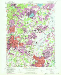
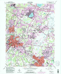
1954 Map of Morristown
USGS Topo · Published 1972About this map
Washington Headquarters (National Park) stands as a focal point in this landscape of rapid mid-century suburbanization. The map documents the shifting character of Morris County, where residential expansion in Parsippany and Florham Park begins to surround established institutions like Greystone Park State Hospital and Drew University. The rail infrastructure is well-defined, showing the intersection of the Lackawanna RR and the Morristown and Erie RR which historically fueled the industrial growth of Whippany and Morristown.
Find a feature on this map
77 named features on this map. Tap any name to fly to it.
Don’t see what you’re looking for? This feature index may not catch every label — zoom into the map to look around manually.
Map Details
Editions of this 1954 Morristown Map
5 editions found
Other maps of this area

1888 · Plainfield
USGS Topo · 1:62,500

1888 · Morristown
USGS Topo · 1:62,500

1888 · Lake Hopatcong
USGS Topo · 1:62,500

1891 · Somerville
USGS Topo · 1:62,500

1893 · Plainfield
USGS Topo · 1:62,500

1893 · Somerville
USGS Topo · 1:62,500

1894 · Morristown
USGS Topo · 1:62,500

1894 · Lake Hopatcong
USGS Topo · 1:62,500

1898 · Lake Hopatcong
USGS Topo · 1:62,500

1898 · Morristown
USGS Topo · 1:62,500