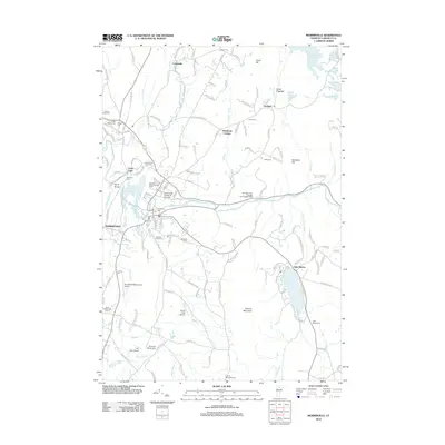
2012 Map of Morrisville
USGS Topo · Published 2012About this map
The Lamoille River defines the corridor of this North-Central Vermont landscape, winding past the village of Morristown and through Lake Lamoille. The rail legacy of the region is anchored by the Lamoille Valley Railroad Depot, while modern aviation is represented by Morrisville-Stowe State Airport and Perras Field Airport. This survey provides extensive genealogical detail, documenting numerous burial sites such as Saint Teresa Cem, Jedidia Hyde Cem, and the Plains-Green Lawn Cem. To the east, Elmore State Park surrounds Lake Elmore at the base of Elmore Mountain, showing the area's transition from an industrial and agricultural hub into a center for recreation and education, highlighted by the Community College of Vermont. Smaller settlements like Centerville and Garfield are situated among a network of brooks and reservoirs, including the Green River Reservoir.
Find a feature on this map
156 named features on this map. Tap any name to fly to it.
Don’t see what you’re looking for? This feature index may not catch every label — zoom into the map to look around manually.
Map Details
Editions of this 2012 Morrisville Map
This is the sole edition of this map. No revisions or reprints were ever made.
Other maps of this area

1919 · Montpelier
USGS Topo · 1:62,500

1921 · Montpelier
USGS Topo · 1:62,500

1927 · Hyde Park
USGS Topo · 1:48,000

1928 · Hardwick
USGS Topo · 1:62,500

1930 · Hyde Park
USGS Topo · 1:62,500

1934 · Hardwick
USGS Topo · 1:48,000

1938 · Hardwick
USGS Topo · 1:62,500

1939 · Plainfield
USGS Topo · 1:48,000

1940 · Plainfield
USGS Topo · 1:62,500

1943 · Plainfield
USGS Topo · 1:62,500