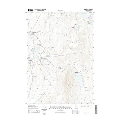
2015 Map of Morrisville
USGS Topo · Published 2015About this map
The Lamoille River and the Lamoille Valley RR corridor anchor this mid-2010s survey of Lamoille County, Vermont. Central to the landscape is the transition from the bustling village of Morrisville to the surrounding rural hamlets like Cadys Falls, Cleveland Corners, and Centerville. Genealogy researchers will find an exceptional density of historical burial grounds, including the Jedidia Hyde Cem near the town center and the Elmore Mountain Cem in the south.
Find a feature on this map
145 named features on this map. Tap any name to fly to it.
Don’t see what you’re looking for? This feature index may not catch every label — zoom into the map to look around manually.
Map Details
Editions of this 2015 Morrisville Map
This is the sole edition of this map. No revisions or reprints were ever made.
Other maps of this area

1919 · Montpelier
USGS Topo · 1:62,500

1921 · Montpelier
USGS Topo · 1:62,500

1927 · Hyde Park
USGS Topo · 1:48,000

1928 · Hardwick
USGS Topo · 1:62,500

1930 · Hyde Park
USGS Topo · 1:62,500

1934 · Hardwick
USGS Topo · 1:48,000

1938 · Hardwick
USGS Topo · 1:62,500

1939 · Plainfield
USGS Topo · 1:48,000

1940 · Plainfield
USGS Topo · 1:62,500

1943 · Plainfield
USGS Topo · 1:62,500