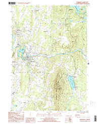
1999 Map of Morrisville
USGS Topo · Published 2000About this map
Morrisville and Hyde Park serve as the primary population centers along the winding Lamoille River in this late 20th-century survey. The landscape is defined by the sharp contrast between the industrial and residential corridors of the river valley and the steep, wooded elevations of the Worcester Mountains. To the east, Elmore Mountain rises over Lake Elmore, crowned by the Elmore Fire Lookout Tower, while the northern reaches show the expanses of the Green River Res. The map documents a mix of agricultural history and resource extraction, visible in labels like the Lower Diggings and various gravel pits. Smaller settlements like Cadys Falls, Centerville, and Garfield provide essential reference points for genealogists tracing family locations across Morristown and Wolcott townships during this era of Vermont's development.
Find a feature on this map
46 named features on this map. Tap any name to fly to it.
Don’t see what you’re looking for? This feature index may not catch every label — zoom into the map to look around manually.
Map Details
Editions of this 1999 Morrisville Map
This is the sole edition of this map. No revisions or reprints were ever made.
Other maps of this area

1919 · Montpelier
USGS Topo · 1:62,500

1921 · Montpelier
USGS Topo · 1:62,500

1927 · Hyde Park
USGS Topo · 1:48,000

1928 · Hardwick
USGS Topo · 1:62,500

1930 · Hyde Park
USGS Topo · 1:62,500

1934 · Hardwick
USGS Topo · 1:48,000

1938 · Hardwick
USGS Topo · 1:62,500

1939 · Plainfield
USGS Topo · 1:48,000

1940 · Plainfield
USGS Topo · 1:62,500

1943 · Plainfield
USGS Topo · 1:62,500