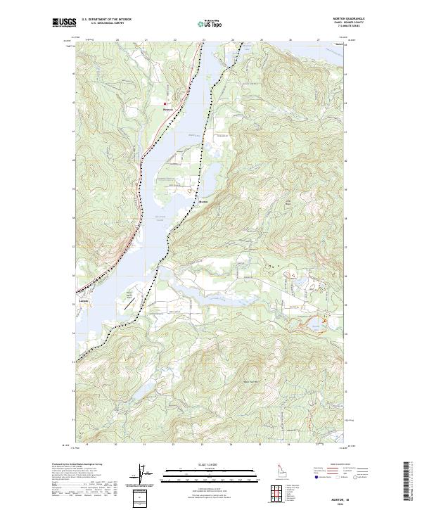
2024 Map of Morton
USGS Topo · Published 2024About this map
Lake Pend Oreille dominates the central landscape of this Bonner County survey, providing a deep-water focal point for the surrounding settlements of Wrencoe, Morton, and Laclede. The geography is defined by the transition from the lake into the Pend Oreille River in the northwest, while the southern reaches are marked by the wetlands of Round Lake and the winding course of Cocolalla Creek. Residential growth is evident in the network of local roads such as Wrenco Loop and Ponderesa Ranch Rd, which weave through the timbered terrain toward the water's edge.
Find a feature on this map
89 named features on this map. Tap any name to fly to it.
Don’t see what you’re looking for? This feature index may not catch every label — zoom into the map to look around manually.
Map Details
Editions of this 2024 Morton Map
This is the sole edition of this map. No revisions or reprints were ever made.
Other maps of this area

1901 · Sandpoint
USGS Topo · 1:125,000

1911 · Priest Lake
USGS Topo · 1:250,000

1911 · Sandpoint
USGS Topo · 1:125,000

1913 · Priest Lake
USGS Topo · 1:250,000

1958 · Sandpoint
USGS Topo · 1:250,000

1963 · Sandpoint
USGS Topo · 1:250,000

1967 · Prater Mtn
USGS Topo · 1:24,000
1968 · Cocolalla
USGS Topo · 1:24,000
1968 · Happy Fork Gap
USGS Topo · 1:24,000
1968 · Morton
USGS Topo · 1:24,000