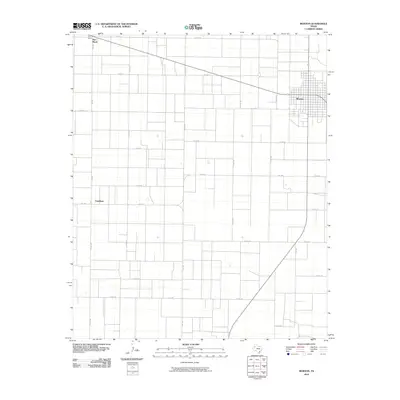
2010 Map of Morton
USGS Topo · Published 2010About this map
Morton serves as the primary municipal center in this section of Cochran County, situated at the intersection of State Highway 114 and 214. The landscape is defined by the rigid geometry of the Texas High Plains, where a dense grid of county roads—such as Co RD 64 and Co RD 130—facilitates access to the surrounding agricultural tracts. Small outposts and crossroads like Famuliner and the Star Route area punctuate the otherwise open terrain, reflecting the dispersed nature of rural settlement in the region. The network of farm-to-market roads, including Fm 1169 and Fm 3304, illustrates the vital transport infrastructure supporting the local ranching and farming economy during the early 21st century.
Find a feature on this map
23 named features on this map. Tap any name to fly to it.
Don’t see what you’re looking for? This feature index may not catch every label — zoom into the map to look around manually.
Map Details
Editions of this 2010 Morton Map
This is the sole edition of this map. No revisions or reprints were ever made.
Other maps of this area

1954 · Brownfield
USGS Topo · 1:250,000

1958 · Brownfield
USGS Topo · 1:250,000

1962 · Brownfield
USGS Topo · 1:250,000

1969 · Maple
USGS Topo · 1:24,000

1969 · Enochs
USGS Topo · 1:24,000

1969 · Lehman
USGS Topo · 1:24,000

1970 · Morton SW
USGS Topo · 1:24,000

1970 · Whiteface SW
USGS Topo · 1:24,000

1970 · Morton NW
USGS Topo · 1:24,000

1971 · Whiteface NW
USGS Topo · 1:24,000