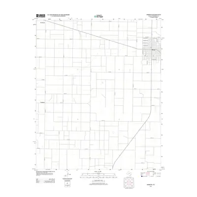
2012 Map of Morton
USGS Topo · Published 2012About this map
Morton serves as the primary municipal anchor for this section of Cochran County, situated at the junction of several critical regional transit lines. The town’s grid is clearly defined by named thoroughfares such as W Polk Ave and E Harding Ave, illustrating a classic West Texas settlement pattern organized around agricultural accessibility. Outside the main township, the landscape is defined by an extensive network of county roads including Co Rd-74 and Co Rd-120, which carve the terrain into large, rectangular tracts. Smaller, named locations like Famuliner and Star Route appear along these routes, marking specific nodes in the rural geography. This 2012 survey captures the area’s reliance on farm-to-market roads like Fm-1169 and Fm-1779, which facilitate the movement of goods through the high plains environment.
Find a feature on this map
31 named features on this map. Tap any name to fly to it.
Don’t see what you’re looking for? This feature index may not catch every label — zoom into the map to look around manually.
Map Details
Editions of this 2012 Morton Map
This is the sole edition of this map. No revisions or reprints were ever made.
Other maps of this area

1954 · Brownfield
USGS Topo · 1:250,000

1958 · Brownfield
USGS Topo · 1:250,000

1962 · Brownfield
USGS Topo · 1:250,000

1969 · Maple
USGS Topo · 1:24,000

1969 · Enochs
USGS Topo · 1:24,000

1969 · Lehman
USGS Topo · 1:24,000

1970 · Morton SW
USGS Topo · 1:24,000

1970 · Whiteface SW
USGS Topo · 1:24,000

1970 · Morton NW
USGS Topo · 1:24,000

1971 · Whiteface NW
USGS Topo · 1:24,000