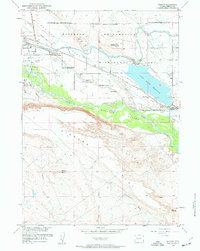
1959 Map of Morton
USGS Topo · Published 1961About this map
Wind River waters and intricate irrigation systems define this mid-century landscape in Fremont County. The map documents the extensive water management infrastructure of the era, including the Wyoming Canal, the Pilot Wasteway, and the Pilot Butte Reservoir, which was essential for local reclamation efforts. Significant industrial activity is evident at the Pilot Butte Oil Field and the Pilot Butte Power Plant, while the Pilot Mine and several gravel pits dot the northern flats. The region's cultural history is marked by the Wind River Indian Reservation Boundary and family-named landmarks such as Hurtado Cem and Chavez Cem. The terrain transitions from the high elevations of Bighorn and Bighorn Butte in the south down into the fertile Kinnear Valley and across the broad expanse of Mexican Flat.
Find a feature on this map
28 named features on this map. Tap any name to fly to it.
Don’t see what you’re looking for? This feature index may not catch every label — zoom into the map to look around manually.
Map Details
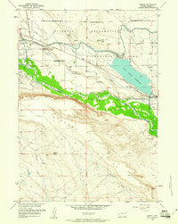
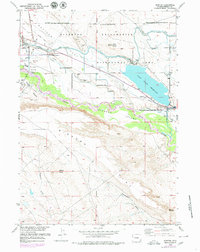
Editions of this 1959 Morton Map
3 editions found
Other maps of this area

1950 · Pavillion
USGS Topo · 1:24,000

1950 · Pavillion Butte
USGS Topo · 1:24,000

1951 · Lookout Butte SW
USGS Topo · 1:24,000

1951 · Mule Butte
USGS Topo · 1:24,000

1951 · Morton
USGS Topo · 1:24,000

1951 · Fort Washakie
USGS Topo · 1:24,000

1951 · Lookout Butte
USGS Topo · 1:24,000

1951 · Argo Butte
USGS Topo · 1:24,000

1951 · Ethete
USGS Topo · 1:24,000

1955 · Thermopolis
USGS Topo · 1:250,000