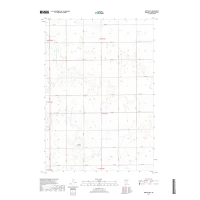
2019 Map of Morton NW
USGS Topo · Published 2019About this map
Lothert's Farm Strip sits in the southwest portion of this landscape, serving as a rare named landmark in an area primarily defined by an intensive agricultural drainage network. In this corner of Renville County, the natural hydrology of the E Fork Beaver Cr is heavily supplemented by an engineered system of waterways, including County Ditch Number One Hundred Fortyfour, County Ditch Number One Hundred Twentyfour, and Ditch Number Eightyfive-a. This intricate grid of ditches and township roads, such as Co RD 17 and Co HWY 4, illustrates the comprehensive mid-20th-century effort to manage the prairie wetlands for high-yield farming. The map captures a quintessential Minnesota agricultural township structure, where section lines dictate the placement of nearly every road and drainage feature.
Find a feature on this map
25 named features on this map. Tap any name to fly to it.
Don’t see what you’re looking for? This feature index may not catch every label — zoom into the map to look around manually.
Map Details
Editions of this 2019 Morton NW Map
This is the sole edition of this map. No revisions or reprints were ever made.
Other maps of this area

1952 · Morton
USGS Topo · 1:62,500

1952 · Redwood Falls
USGS Topo · 1:62,500

1953 · New Ulm
USGS Topo · 1:250,000

1957 · New Ulm
USGS Topo · 1:250,000

1957 · Olivia
USGS Topo · 1:62,500

1958 · New Ulm
USGS Topo · 1:250,000

1965 · Danube
USGS Topo · 1:24,000

1967 · New Ulm
USGS Topo · 1:250,000
1982 · Olivia SE
USGS Topo · 1:24,000
1982 · Redwood Falls
USGS Topo · 1:24,000