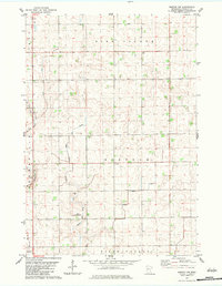
1983 Map of Morton NW
USGS Topo · Published 1983About this map
The township boundaries of Bird Island, Norfolk, and Birch Cooley meet across this agrarian landscape in southern Renville County. Captured in the early 1980s, the terrain is defined by a systematic network of agricultural water management, including Ditch No 144, Ditch No 63, and Ditch No 124. These man-made channels intersect with the natural drainage of Birch Coulee Creek and Birch Coulee, illustrating the intensive modification of the Minnesota prairie for large-scale farming. A lone Townhall stands in the center of Norfolk, while the Lotherts Landing Strip and a local Gravel Pit indicate the small-scale infrastructure supporting this rural community. The map provides a detailed record of section lines and property access roads that shaped the region's development during the late twentieth century.
Find a feature on this map
15 named features on this map. Tap any name to fly to it.
Don’t see what you’re looking for? This feature index may not catch every label — zoom into the map to look around manually.
Map Details
Editions of this 1983 Morton NW Map
This is the sole edition of this map. No revisions or reprints were ever made.
Other maps of this area

1952 · Morton
USGS Topo · 1:62,500

1952 · Redwood Falls
USGS Topo · 1:62,500

1953 · New Ulm
USGS Topo · 1:250,000

1957 · New Ulm
USGS Topo · 1:250,000

1957 · Olivia
USGS Topo · 1:62,500

1958 · New Ulm
USGS Topo · 1:250,000

1965 · Danube
USGS Topo · 1:24,000

1967 · New Ulm
USGS Topo · 1:250,000
1982 · Olivia SE
USGS Topo · 1:24,000
1982 · Redwood Falls
USGS Topo · 1:24,000