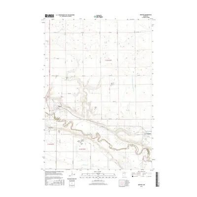
2016 Map of Morton
USGS Topo · Published 2016About this map
The Minnesota River and its meandering valley dictate the geography of this Renville County landscape, where the settlements of Morton and Franklin serve as local hubs. This area is particularly significant for genealogists and local historians due to the high density of small burial sites and family plots scattered across the township. Notable locations include the Lower Sioux Community Cem, the Patten Pioneer Cem, and individual markers like the Honorable JW Lynde Burial Plot and the Andrew Robertson Grave.
Find a feature on this map
48 named features on this map. Tap any name to fly to it.
Don’t see what you’re looking for? This feature index may not catch every label — zoom into the map to look around manually.
Map Details
Editions of this 2016 Morton Map
This is the sole edition of this map. No revisions or reprints were ever made.
Other maps of this area

1952 · Morton
USGS Topo · 1:62,500

1952 · Redwood Falls
USGS Topo · 1:62,500

1953 · Morgan
USGS Topo · 1:62,500

1953 · New Ulm
USGS Topo · 1:250,000

1957 · New Ulm
USGS Topo · 1:250,000

1958 · New Ulm
USGS Topo · 1:250,000

1967 · New Ulm
USGS Topo · 1:250,000

1967 · Clements
USGS Topo · 1:24,000
1982 · Morgan NE
USGS Topo · 1:24,000
1982 · Redwood Falls
USGS Topo · 1:24,000