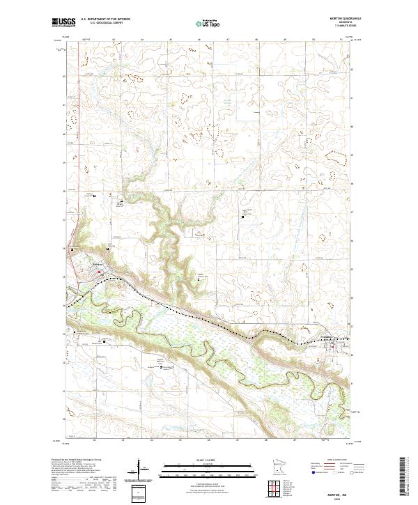
2022 Map of Morton
USGS Topo · Published 2022About this map
The winding Minnesota River corridor and its surrounding bluffs anchor this study of Morton and the nearby town of Franklin. The landscape is heavily marked by its early history and the heritage of the Lower Sioux Indian Reservation, which includes the Lower Sioux Community Cem and the Newton Cem. This area is particularly significant for genealogists, as it contains numerous isolated memorial sites and family-named landmarks including the Andrew Robertson Grave, the Honorable J W Lynde Grave, and the Peavey Grave Site.
Find a feature on this map
53 named features on this map. Tap any name to fly to it.
Don’t see what you’re looking for? This feature index may not catch every label — zoom into the map to look around manually.
Map Details
Editions of this 2022 Morton Map
This is the sole edition of this map. No revisions or reprints were ever made.
Other maps of this area

1952 · Morton
USGS Topo · 1:62,500

1952 · Redwood Falls
USGS Topo · 1:62,500

1953 · Morgan
USGS Topo · 1:62,500

1953 · New Ulm
USGS Topo · 1:250,000

1957 · New Ulm
USGS Topo · 1:250,000

1958 · New Ulm
USGS Topo · 1:250,000

1967 · New Ulm
USGS Topo · 1:250,000

1967 · Clements
USGS Topo · 1:24,000
1982 · Morgan NE
USGS Topo · 1:24,000
1982 · Redwood Falls
USGS Topo · 1:24,000