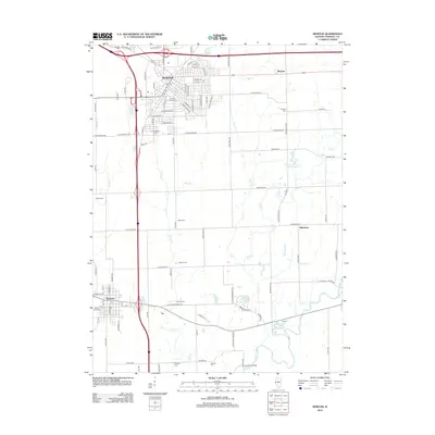
2012 Map of Morton
USGS Topo · Published 2012About this map
Morton and the surrounding Tazewell County countryside are depicted in this 2012 survey, showcasing the dense residential grid of the village alongside the expansive agricultural tracts of Central Illinois. The landscape is defined by its numerous small burial grounds and rural homesteads, including Aberle Farms and the Apostolic Christian Cem. Significant watercourses such as the Mackinaw River and Prairie Cr wind through the southern sections of the quadrangle, where the Vaughter Bridge crosses the river near the settlement of Menert.
Find a feature on this map
108 named features on this map. Tap any name to fly to it.
Don’t see what you’re looking for? This feature index may not catch every label — zoom into the map to look around manually.
Map Details
Editions of this 2012 Morton Map
This is the sole edition of this map. No revisions or reprints were ever made.
Other maps of this area

1905 · Peoria
USGS Topo · 1:62,500

1927 · Peoria
USGS Topo · 1:62,500

1928 · Mackinaw
USGS Topo · 1:62,500

1932 · Mackinaw
USGS Topo · 1:62,500

1942 · Delavan
USGS Topo · 1:62,500

1949 · Peoria East
USGS Topo · 1:24,000
1950 · Peoria East
USGS Topo · 1:24,000

1951 · Minier
USGS Topo · 1:62,500

1958 · Peoria
USGS Topo · 1:250,000

1960 · Marquette Heights
USGS Topo · 1:24,000