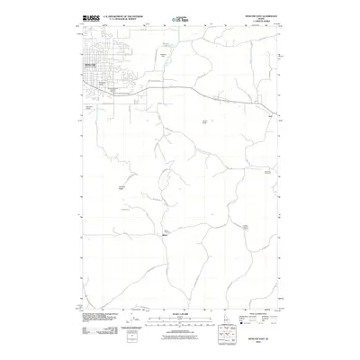
2010 Map of Moscow East
USGS Topo · Published 2010About this map
Paradise Ridge and Tomer Butte dominate the landscape east of the growing city of Moscow, defining the high ground above the drainage basins of the South Fork Palouse River and Middle Potlatch Creek. This 2010 survey illustrates the transition from the urban grid near the Moscow Post Office to the agricultural reaches of Haskins Flat and Paradise Valley. The map is particularly useful for genealogical research, identifying numerous small burial sites such as the Cordelia Lutheran Cemetery and the Blaine Cemetery near the settlement of Blaine. Transportation networks are well-defined, showing the connection between the city and outlying points like Joel via roads such as Lenville Rd and Genesee Troy Rd, reflecting the modern rural infrastructure of Latah County.
Find a feature on this map
47 named features on this map. Tap any name to fly to it.
Don’t see what you’re looking for? This feature index may not catch every label — zoom into the map to look around manually.
Map Details
Editions of this 2010 Moscow East Map
This is the sole edition of this map. No revisions or reprints were ever made.
Other maps of this area

1910 · Pullman
USGS Topo · 1:125,000

1955 · Pullman
USGS Topo · 1:250,000

1958 · Pullman
USGS Topo · 1:250,000

1960 · Troy
USGS Topo · 1:24,000

1960 · Robinson Lake
USGS Topo · 1:24,000

1960 · Moscow Mtn
USGS Topo · 1:24,000

1960 · Moscow East
USGS Topo · 1:24,000

1960 · Potlatch
USGS Topo · 1:62,500

1961 · Moscow
USGS Topo · 1:62,500

1964 · Viola
USGS Topo · 1:24,000