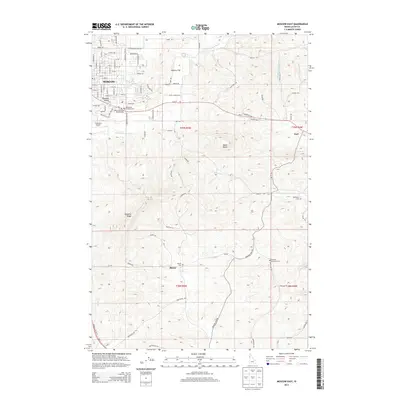
2013 Map of Moscow East
USGS Topo · Published 2013About this map
Moscow serves as the primary urban center in this 2013 survey, which documents the transition from city streets to the surrounding agricultural uplands and rolling hills. The landscape is defined by notable elevations such as Paradise Ridge and Tomer Butte, which rise above the drainages of the S Fork Palouse River and Little Potlatch Cr. Small settlements and named locales like Paradise Valley, Joel, and Blaine are scattered across the quadrangle, illustrating the historical rural settlement patterns of Latah County. The map is particularly useful for genealogical research, identifying several burial sites including Blaine Cem, Buchanan Cem, and the Cordelia Lutheran Cem. Transportation corridors weave through the terrain, connecting the residential blocks of Moscow to more remote landmarks like Haskins Flat and the Fountains Airport.
Find a feature on this map
98 named features on this map. Tap any name to fly to it.
Don’t see what you’re looking for? This feature index may not catch every label — zoom into the map to look around manually.
Map Details
Editions of this 2013 Moscow East Map
This is the sole edition of this map. No revisions or reprints were ever made.
Other maps of this area

1910 · Pullman
USGS Topo · 1:125,000

1955 · Pullman
USGS Topo · 1:250,000

1958 · Pullman
USGS Topo · 1:250,000

1960 · Troy
USGS Topo · 1:24,000

1960 · Robinson Lake
USGS Topo · 1:24,000

1960 · Moscow Mtn
USGS Topo · 1:24,000

1960 · Moscow East
USGS Topo · 1:24,000

1960 · Potlatch
USGS Topo · 1:62,500

1961 · Moscow
USGS Topo · 1:62,500

1964 · Viola
USGS Topo · 1:24,000