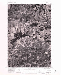
1975 Map of Moscow East
USGS Topo · Published 1978About this map
The city of Moscow anchors the northwestern corner of this orthophotoquad, transitioning from a dense grid of urban streets into the productive agricultural landscape of the Palouse. Prepared from 1975 aerial photography, the imagery provides an overhead view of the land's rhythmic patterns of cultivation and drainage, showing the interface between developing town limits and the surrounding wheat and pea country. The South Fork Palouse River winds through the northern half of the sheet, serving as a primary drainage corridor for the rolling hills. Smaller rural settlements such as Joel and Blaine appear as modest clusters of structures along regional transit routes, while Tomer Butte stands out as a prominent high point in the central terrain. This document captures the physical layout of Latah County just before the rapid suburban expansion of the late 1970s, making it a valuable tool for tracking land use and the growth of the university town.
Find a feature on this map
5 named features on this map. Tap any name to fly to it.
Don’t see what you’re looking for? This feature index may not catch every label — zoom into the map to look around manually.
Map Details
Editions of this 1975 Moscow East Map
This is the sole edition of this map. No revisions or reprints were ever made.
Other maps of this area

1910 · Pullman
USGS Topo · 1:125,000

1955 · Pullman
USGS Topo · 1:250,000

1958 · Pullman
USGS Topo · 1:250,000

1960 · Troy
USGS Topo · 1:24,000

1960 · Robinson Lake
USGS Topo · 1:24,000

1960 · Moscow Mtn
USGS Topo · 1:24,000

1960 · Moscow East
USGS Topo · 1:24,000

1960 · Potlatch
USGS Topo · 1:62,500

1961 · Moscow
USGS Topo · 1:62,500

1964 · Viola
USGS Topo · 1:24,000