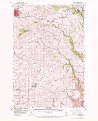
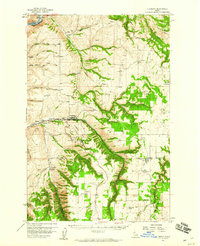
1961 Map of Moscow
USGS Topo · Published 1971About this map
Moscow serves as the focal point of this Inland Empire landscape, situated just west of the Northern Pacific rail line and the prominent Tomer Butte. The map illustrates a transitional landscape where the urban footprint of the city meets the rolling agricultural plateaus of the Palouse. Settlement patterns are defined by small crossroads communities and rural landmarks such as Blaine, Cornwall, and the Aspendale Community Hall. To the south, the Nez Perce Indian Reservation Boundary marks a significant historical and administrative transition across the terrain. The network of small watercourses, including Paradise Creek and Thorn Creek, dictates the placement of early homesteads and cemeteries like Buchanan Cem and Overacker Cem, reflecting the region's deep roots in dryland farming and rural community life before the era of modern highway expansion.
Find a feature on this map
37 named features on this map. Tap any name to fly to it.
Don’t see what you’re looking for? This feature index may not catch every label — zoom into the map to look around manually.
Map Details
Editions of this 1961 Moscow Map
2 editions found
Other maps of this area

1910 · Pullman
USGS Topo · 1:125,000

1945 · Clarkston
USGS Topo · 1:62,500

1948 · Clarkston
USGS Topo · 1:62,500

1955 · Pullman
USGS Topo · 1:250,000

1958 · Pullman
USGS Topo · 1:250,000
1958 · Lapwai
USGS Topo · 1:24,000
1958 · Lewiston Orchards North
USGS Topo · 1:24,000

1958 · Lewiston Orchards
USGS Topo · 1:62,500
1958 · Culdesac
USGS Topo · 1:62,500
1960 · Troy
USGS Topo · 1:24,000