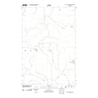
2011 Map of Moscow Mountain
USGS Topo · Published 2011About this map
Moscow Mountain and the Palouse Range dominate this Idaho landscape, rising sharply above the headwaters of numerous creeks. The northern slopes are defined by the drainages of Hatter Creek and Long Creek, while the southern reaches descend toward Randall Flat. This survey captures the area's dual role as both a working forest and a recreational hub, featuring the Lamarack Ski Area and the Moscow Mountain Picnic Area along the central ridge.
Find a feature on this map
43 named features on this map. Tap any name to fly to it.
Don’t see what you’re looking for? This feature index may not catch every label — zoom into the map to look around manually.
Map Details
Editions of this 2011 Moscow Mountain Map
This is the sole edition of this map. No revisions or reprints were ever made.
Other maps of this area

1955 · Pullman
USGS Topo · 1:250,000

1958 · Pullman
USGS Topo · 1:250,000

1960 · Troy
USGS Topo · 1:24,000

1960 · Robinson Lake
USGS Topo · 1:24,000

1960 · Moscow Mtn
USGS Topo · 1:24,000

1960 · Moscow East
USGS Topo · 1:24,000

1960 · Potlatch
USGS Topo · 1:62,500

1961 · Deary
USGS Topo · 1:62,500

1961 · Kendrick
USGS Topo · 1:62,500

1961 · Moscow
USGS Topo · 1:62,500