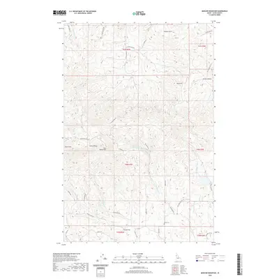
2020 Map of Moscow Mountain
USGS Topo · Published 2020About this map
The Palouse Range defines the northwest corner of this Latah County quadrangle, where the high peaks of Moscow Mtn and East Moscow Mtn dominate the skyline. This upland terrain transitions southward into a complex network of timbered ridges and valleys drained by numerous watercourses, including Hatter Cr and Big Meadow Cr. The infrastructure of the era is visible through a web of forest and county roads such as Moscow Mountain Rd and Tamarack Rd, which connect remote geographic points like Turnbow Point and Basalt Hill.
Find a feature on this map
44 named features on this map. Tap any name to fly to it.
Don’t see what you’re looking for? This feature index may not catch every label — zoom into the map to look around manually.
Map Details
Editions of this 2020 Moscow Mountain Map
This is the sole edition of this map. No revisions or reprints were ever made.
Other maps of this area

1955 · Pullman
USGS Topo · 1:250,000

1958 · Pullman
USGS Topo · 1:250,000

1960 · Troy
USGS Topo · 1:24,000

1960 · Robinson Lake
USGS Topo · 1:24,000

1960 · Moscow Mtn
USGS Topo · 1:24,000

1960 · Moscow East
USGS Topo · 1:24,000

1960 · Potlatch
USGS Topo · 1:62,500

1961 · Deary
USGS Topo · 1:62,500

1961 · Kendrick
USGS Topo · 1:62,500

1961 · Moscow
USGS Topo · 1:62,500