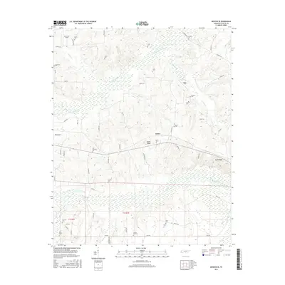
2016 Map of Moscow SE
USGS Topo · Published 2016About this map
Moscow and La Grange anchor this rural Fayette County landscape, where the Wolf River and its various tributaries like the N Fork Wolf River and Watkins Creek carve through the terrain. The area is notable for its high density of family and community burial grounds, providing a significant resource for genealogical research. Locations such as Shiloh Cem, Macedonia Cem, and New Friendship Cem are distributed across the countryside, often near historic road traces like Cowan Loop and Leatherwood Rd. The map also reveals the rural aviation history of the region through Hawks Nest Airport and Wilson Field. A curious local designation, Forty Five, sits near the center of the sheet, while the southern portion is defined by the marshy lowlands of the river basin and the surveyed grid of t1s r1w and t1s r2w.
Find a feature on this map
58 named features on this map. Tap any name to fly to it.
Don’t see what you’re looking for? This feature index may not catch every label — zoom into the map to look around manually.
Map Details
Editions of this 2016 Moscow SE Map
This is the sole edition of this map. No revisions or reprints were ever made.
Other maps of this area

1949 · Moscow
USGS Topo · 1:62,500

1950 · Ashland
USGS Topo · 1:62,500

1950 · Grand Junction
USGS Topo · 1:24,000

1951 · Hickory Valley
USGS Topo · 1:24,000

1951 · Grand Junction
USGS Topo · 1:24,000

1953 · Holly Springs
USGS Topo · 1:62,500

1956 · Blytheville
USGS Topo · 1:250,000

1956 · Tupelo
USGS Topo · 1:250,000

1958 · Tupelo
USGS Topo · 1:250,000

1959 · Blytheville
USGS Topo · 1:250,000