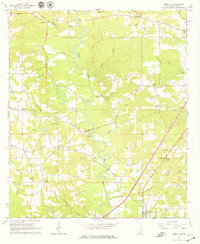
1965 Map of Moselle
USGS Topo · Published 1979About this map
The Leaf River creates a winding central spine through this Jones County landscape, where timbered tracts and river bottoms meet mid-century development. Established community life is anchored by numerous rural congregations and burial grounds, such as Sweetwater Ch and the Crosby Cem located just east of the river. The small settlement of Moselle sits in the southeast corner, positioned near the SOUTHERN Creek drainage and a network of local roads that define the area's movement.
Find a feature on this map
42 named features on this map. Tap any name to fly to it.
Don’t see what you’re looking for? This feature index may not catch every label — zoom into the map to look around manually.
Map Details
Editions of this 1965 Moselle Map
3 editions found
Other maps of this area

1953 · Hattiesburg
USGS Topo · 1:250,000

1958 · Hattiesburg
USGS Topo · 1:250,000

1963 · Barrontown
USGS Topo · 1:24,000

1964 · Laurel West
USGS Topo · 1:24,000

1964 · Seminary
USGS Topo · 1:24,000

1964 · Ellisville
USGS Topo · 1:24,000

1965 · Hebron
USGS Topo · 1:24,000

1965 · Eastabuchie
USGS Topo · 1:24,000

1965 · Hot Coffee
USGS Topo · 1:24,000

1965 · Moselle
USGS Topo · 1:24,000