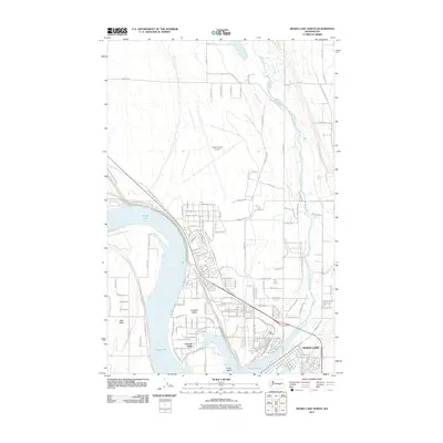
2011 Map of Moses Lake North
USGS Topo · Published 2011About this map
Moses Lake dominates the center of this Grant County landscape, providing a terminal point for the wandering Crab Creek as it flows from the northeast. The residential expansion of the city is evident in the established neighborhoods of Cascade Valley, Mae Valley, and Vista Village, which wrap around the southern shoreline. To the north, the sprawling infrastructure of the Grant County Airport reflects the region's aviation and logistical importance. The surrounding terrain is organized by a meticulous grid of rural roads, including Road 11 NE and Road H NE, which support the agricultural tracts of the Columbia Basin. This survey documents the intersection of suburban growth and industrial utility, from the city's street grid to the open waters surrounding Crest Island.
Find a feature on this map
148 named features on this map. Tap any name to fly to it.
Don’t see what you’re looking for? This feature index may not catch every label — zoom into the map to look around manually.
Map Details
Editions of this 2011 Moses Lake North Map
This is the sole edition of this map. No revisions or reprints were ever made.
Other maps of this area

1912 · Moses Lake
USGS Topo · 1:62,500

1923 · Wheeler
USGS Topo · 1:62,500

1925 · Wheeler
USGS Topo · 1:62,500

1953 · Ritzville
USGS Topo · 1:250,000

1956 · Wheeler
USGS Topo · 1:24,000

1956 · Moses Lake South
USGS Topo · 1:24,000

1956 · Grant Orchards
USGS Topo · 1:24,000

1956 · Moses Lake North
USGS Topo · 1:24,000

1956 · Gloyd
USGS Topo · 1:24,000

1956 · Wilson Creek SW
USGS Topo · 1:24,000