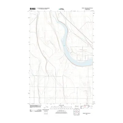
2011 Map of Moses Lake NW
USGS Topo · Published 2011About this map
The northern reaches of Moses Lake dominate this 2011 survey, where the water curves through a landscape increasingly defined by a formal grid of rural and suburban development in Grant County. The transport network reflects the region’s agricultural and residential growth, with arterial routes like Hiawatha Rd Ne and Division Rd N providing the primary structure for the terrain. Near the water's edge, more specialized residential naming conventions appear, including Lake Vista Rd Ne and Heron Way, suggesting the transition from open farmland to lakeside living. Historical traces of older naming patterns persist in labels such as Neppel Rd Ne, a nod to the area's early settlement history before the mid-century irrigation projects transformed the Columbia Basin. The map captures a specific moment of expansion, illustrating how modern road systems like Stonecrest Rd Ne have been laid out across the undulating geography of central Washington.
Find a feature on this map
24 named features on this map. Tap any name to fly to it.
Don’t see what you’re looking for? This feature index may not catch every label — zoom into the map to look around manually.
Map Details
Editions of this 2011 Moses Lake NW Map
This is the sole edition of this map. No revisions or reprints were ever made.
Other maps of this area

1910 · Winchester
USGS Topo · 1:62,500

1912 · Moses Lake
USGS Topo · 1:62,500

1953 · Ritzville
USGS Topo · 1:250,000

1956 · Ephrata
USGS Topo · 1:62,500

1956 · Moses Lake South
USGS Topo · 1:24,000

1956 · Ephrata
USGS Topo · 1:24,000

1956 · Grant Orchards
USGS Topo · 1:24,000

1956 · Moses Lake North
USGS Topo · 1:24,000

1956 · Gloyd
USGS Topo · 1:24,000

1956 · Mae
USGS Topo · 1:24,000