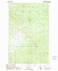
1989 Map of Moses Meadows
USGS Topo · Published 1989About this map
The Colville Indian Reservation and Okanogan National Forest converge in this high-country landscape, where complex jurisdictional boundaries meet along the crests of Mackey Ridge and Moses Mountain. The terrain is defined by a series of prominent peaks and high meadows, including Granite Mtn and Little Moses Mtn, which overlook the headwaters of numerous drainages. Water moves through this system via several distinctive creeks like Loony Creek, Lost Creek, and Stepstone Creek.
Find a feature on this map
23 named features on this map. Tap any name to fly to it.
Don’t see what you’re looking for? This feature index may not catch every label — zoom into the map to look around manually.
Map Details
Editions of this 1989 Moses Meadows Map
3 editions found
Other maps of this area

1902 · Osoyoos
USGS Topo · 1:125,000

1904 · Osoyoos
USGS Topo · 1:125,000

1904 · Republic
USGS Topo · 1:125,000

1951 · Wauconda
USGS Topo · 1:62,500

1952 · Disautel
USGS Topo · 1:62,500

1953 · Bald Knob
USGS Topo · 1:62,500

1954 · Okanogan
USGS Topo · 1:250,000

1957 · Aeneas Valley
USGS Topo · 1:62,500

1958 · Okanogan
USGS Topo · 1:250,000

1958 · Aeneas
USGS Topo · 1:62,500