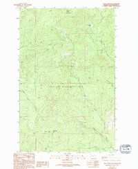
1989 Map of Moses Meadows
USGS Topo · Published 1994About this map
Colville Indian Reservation lands dominate this high-altitude landscape in the late 1980s, centered on the prominent peak of Moses Mountain. The terrain is defined by a series of steep drainages, where Trail Creek and North Star Creek carve deep valleys through the timbered highlands. At the highest elevations, infrastructure for fire observation is evident, including the Lookout Tower Moses Q 6774 atop the primary peak and another Lookout Tower 4525t positioned on a separate ridge.
Find a feature on this map
14 named features on this map. Tap any name to fly to it.
Don’t see what you’re looking for? This feature index may not catch every label — zoom into the map to look around manually.
Map Details
Editions of this 1989 Moses Meadows Map
3 editions found
Other maps of this area

1902 · Osoyoos
USGS Topo · 1:125,000

1904 · Osoyoos
USGS Topo · 1:125,000

1904 · Republic
USGS Topo · 1:125,000

1951 · Wauconda
USGS Topo · 1:62,500

1952 · Disautel
USGS Topo · 1:62,500

1953 · Bald Knob
USGS Topo · 1:62,500

1954 · Okanogan
USGS Topo · 1:250,000

1957 · Aeneas Valley
USGS Topo · 1:62,500

1958 · Okanogan
USGS Topo · 1:250,000

1958 · Aeneas
USGS Topo · 1:62,500