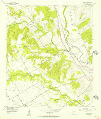
1956 Map of Mosheim
USGS Topo · Published 1957About this map
The Bosque River and the Gulf Colorado and Santa Fe railroad corridor define the geography of this mid-century survey along the border of Bosque and McLennan counties. Small agricultural communities and family landmarks are scattered throughout the hills, including Mosheim, Pendell, and Searsville. The map reflects a landscape in transition, where traditional rural life represented by the Terrell Cemetery, Barton Cem, and Lanes Chapel exists alongside industrial infrastructure like the Pendell Pumping Sta and an extensive pipeline network.
Find a feature on this map
26 named features on this map. Tap any name to fly to it.
Don’t see what you’re looking for? This feature index may not catch every label — zoom into the map to look around manually.
Map Details
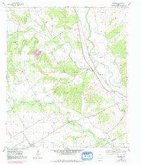
Editions of this 1956 Mosheim Map
2 editions found
Other maps of this area

1888 · Meridian
USGS Topo · 1:125,000

1892 · Waco
USGS Topo · 1:125,000

1894 · Meridian
USGS Topo · 1:125,000

1920 · Waco
USGS Topo · 1:125,000

1931 · Whitney
USGS Topo · 1:62,500

1931 · Valley Mills
USGS Topo · 1:62,500

1954 · Waco
USGS Topo · 1:250,000

1955 · Waco
USGS Topo · 1:250,000

1955 · Clifton
USGS Topo · 1:24,000
1955 · Turnersville
USGS Topo · 1:24,000