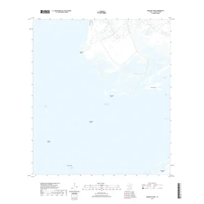
2019 Map of Mosquito Point
USGS Topo · Published 2019About this map
San Antonio Bay dominates this coastal landscape, where the shifting margins of the Texas shoreline meet the gulf. The Intracoastal Waterway cuts a straight course through the open water, serving as a vital artery for maritime traffic between the mainland and the barrier landforms. The map provides a detailed view of the complex island and reef structures that define this estuary, including Turnstake Island, Grass Island, and the avian-named Big Bird Island and Little Bird Island. Near the southern edge, the expansive Matagorda Island acts as a protective buffer against the open sea. This 2019 survey documents the modern configuration of tidal passes like Steamboat Pass and South Pass, while the northern mainland edge is marked by a few rural routes such as Falcon Point Rd and Lodge Rd near Mosquito Point.
Find a feature on this map
16 named features on this map. Tap any name to fly to it.
Don’t see what you’re looking for? This feature index may not catch every label — zoom into the map to look around manually.
Map Details
Editions of this 2019 Mosquito Point Map
This is the sole edition of this map. No revisions or reprints were ever made.
Other maps of this area

1952 · Mosquito Point
USGS Topo · 1:24,000

1952 · Long Island
USGS Topo · 1:24,000

1952 · Mesquite Bay
USGS Topo · 1:24,000

1952 · Tivoli SE
USGS Topo · 1:24,000

1952 · Seadrift NE
USGS Topo · 1:24,000

1952 · Panther Point
USGS Topo · 1:24,000

1952 · Austwell
USGS Topo · 1:24,000

1952 · Seadrift
USGS Topo · 1:24,000
1952 · Panther Point NE
USGS Topo · 1:24,000

1953 · Beeville
USGS Topo · 1:250,000