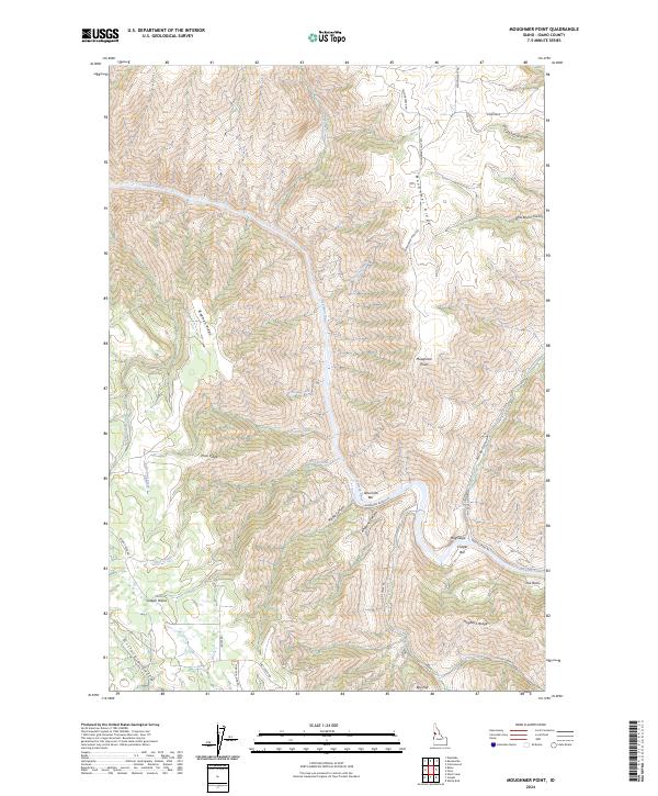
2024 Map of Moughmer Point
USGS Topo · Published 2024About this map
The Salmon River carves a deep, serpentine path through this Idaho landscape, creating distinct riverine features like American Bar and Cooper Bar along its banks. The terrain is defined by a series of prominent elevations, including Moughmer Ridge and Bingman Ridge, which overlook the expansive Joseph Plains to the south. This network of high ridges and deep drainages, such as Maple Canyon and Rocky Canyon, illustrates the complex geography of the region where seasonal waters like Telcher Creek and Wickiup Creek feed into the primary river system.
Find a feature on this map
43 named features on this map. Tap any name to fly to it.
Don’t see what you’re looking for? This feature index may not catch every label — zoom into the map to look around manually.
Map Details
Editions of this 2024 Moughmer Point Map
This is the sole edition of this map. No revisions or reprints were ever made.
Other maps of this area

1924 · Kamiah
USGS Topo · 1:125,000

1955 · Pullman
USGS Topo · 1:250,000

1955 · Grangeville
USGS Topo · 1:250,000

1958 · Pullman
USGS Topo · 1:250,000

1959 · Grangeville
USGS Topo · 1:250,000

1963 · Boles
USGS Topo · 1:24,000

1963 · Moughmer Point
USGS Topo · 1:24,000

1963 · Joseph
USGS Topo · 1:24,000

1963 · White Bird
USGS Topo · 1:24,000

1963 · Wolf Creek
USGS Topo · 1:24,000