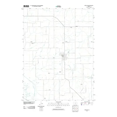
2010 Map of Moulton
USGS Topo · Published 2010About this map
Moulton serves as the central hub for this corner of southern Iowa, situated at a crossroad of local routes like 318th Ave and 550th St. The town contains the Moulton Post Office and sits just north of the Moulton Airport. This landscape is defined by its deep network of rural burial grounds, reflecting the long-established agricultural community. Family and community names appear frequently across the map, from the Staten Cemetery in the southeast to the Orleans Cemetery near the northern settlement of Orleans.
Find a feature on this map
59 named features on this map. Tap any name to fly to it.
Don’t see what you’re looking for? This feature index may not catch every label — zoom into the map to look around manually.
Map Details
Editions of this 2010 Moulton Map
This is the sole edition of this map. No revisions or reprints were ever made.
Other maps of this area

1939 · Centerville
USGS Topo · 1:62,500

1939 · Mystic
USGS Topo · 1:62,500

1941 · Centerville
USGS Topo · 1:62,500

1942 · Mystic
USGS Topo · 1:62,500

1954 · Centerville
USGS Topo · 1:250,000

1957 · Centerville
USGS Topo · 1:250,000

1958 · Centerville
USGS Topo · 1:250,000

1966 · Hiattsville
USGS Topo · 1:24,000

1968 · Unionville
USGS Topo · 1:24,000
1968 · Paris
USGS Topo · 1:24,000