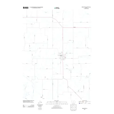
2013 Map of Moulton
USGS Topo · Published 2013About this map
Moulton serves as the central hub of this Southern Iowa landscape, its grid of streets such as W 5th St and E 1st St anchoring the surrounding agricultural plains. The region is defined by a dense network of watercourses, including the Chariton River in the southwest and the Fox River to the north, which carve through the terrain and dictate the placement of rural roads. To the south, the village of Dean sits near the winding Pigeon Cr, while the community of Orleans occupies the northeastern corner. This 2013 survey illustrates the persistence of the section-line road system, where routes like Co Hwy T61 and 330th Ave connect isolated farmsteads with the larger settlements and the headwaters of the N Fabius River.
Find a feature on this map
67 named features on this map. Tap any name to fly to it.
Don’t see what you’re looking for? This feature index may not catch every label — zoom into the map to look around manually.
Map Details
Editions of this 2013 Moulton Map
This is the sole edition of this map. No revisions or reprints were ever made.
Other maps of this area

1939 · Centerville
USGS Topo · 1:62,500

1939 · Mystic
USGS Topo · 1:62,500

1941 · Centerville
USGS Topo · 1:62,500

1942 · Mystic
USGS Topo · 1:62,500

1954 · Centerville
USGS Topo · 1:250,000

1957 · Centerville
USGS Topo · 1:250,000

1958 · Centerville
USGS Topo · 1:250,000

1966 · Hiattsville
USGS Topo · 1:24,000

1968 · Unionville
USGS Topo · 1:24,000
1968 · Paris
USGS Topo · 1:24,000