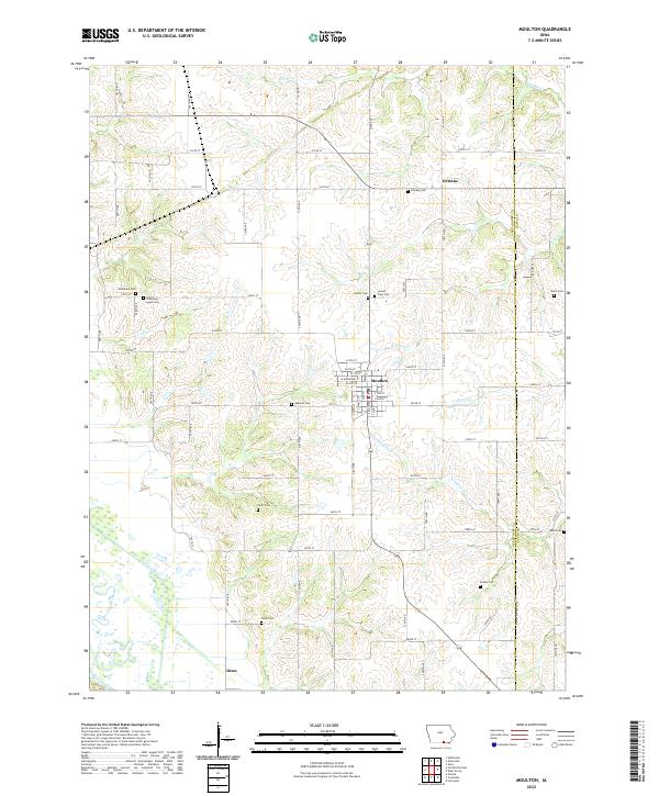
2022 Map of Moulton
USGS Topo · Published 2022About this map
Moulton serves as the primary hub of this southern Appanoose County landscape, defined by a distinct grid of streets including W Broadway St and N Main St. The surrounding countryside is heavily marked by its early settlement history, evidenced by a high density of family and community burial grounds such as Orleans Cem, Otterbein Cem, and Staten Cem. The topography is shaped by an intricate network of waterways, with the Chariton River flowing through the southwest and the Fox River and N Fabius River cutting through the northern and eastern sections. To the north, the small settlement of Orleans sits near the county line, while Dean anchors the southern reaches. This modern survey reflects the enduring rural structure of the region, where gravel roads and section lines connect isolated farmsteads and historic landmarks like Oakland Cem and Sunset View Cem.
Find a feature on this map
85 named features on this map. Tap any name to fly to it.
Don’t see what you’re looking for? This feature index may not catch every label — zoom into the map to look around manually.
Map Details
Editions of this 2022 Moulton Map
This is the sole edition of this map. No revisions or reprints were ever made.
Other maps of this area

1939 · Centerville
USGS Topo · 1:62,500

1939 · Mystic
USGS Topo · 1:62,500

1941 · Centerville
USGS Topo · 1:62,500

1942 · Mystic
USGS Topo · 1:62,500

1954 · Centerville
USGS Topo · 1:250,000

1957 · Centerville
USGS Topo · 1:250,000

1958 · Centerville
USGS Topo · 1:250,000

1966 · Hiattsville
USGS Topo · 1:24,000

1968 · Unionville
USGS Topo · 1:24,000
1968 · Paris
USGS Topo · 1:24,000