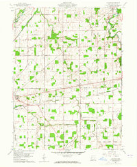
1960 Map of Moulton
USGS Topo · Published 1965About this map
The Old Indian Treaty Boundary slices diagonally through this part of Auglaize County, marking a historic line of land tenure across a landscape dominated by the St Marys River and the Auglaize River. Small rural centers such as Buckland and Moulton are connected by a dense grid of family-named roads like Henschen Road and Schultz Road. The presence of the Miami and Erie Canal (Abandoned) following the river valley serves as a remnant of an earlier transportation era, now superseded by the New York Chicago and St Louis Railroad and the New York Central. Scattered oil wells and local quarries point to the area's mid-century extractive activity, while various burial grounds including Zion Cem and Arnett Cem provide essential anchor points for genealogical research in this agricultural region.
Find a feature on this map
56 named features on this map. Tap any name to fly to it.
Don’t see what you’re looking for? This feature index may not catch every label — zoom into the map to look around manually.
Map Details
Editions of this 1960 Moulton Map
Other maps of this area

1906 · Lima
USGS Topo · 1:62,500

1909 · Loramie
USGS Topo · 1:62,500

1911 · Loramie
USGS Topo · 1:62,500

1911 · Spencerville
USGS Topo · 1:62,500

1913 · Sidney
USGS Topo · 1:62,500

1944 · Sidney
USGS Topo · 1:62,500

1944 · Loramie
USGS Topo · 1:62,500

1944 · Spencerville
USGS Topo · 1:62,500

1953 · Muncie
USGS Topo · 1:250,000

1956 · Muncie
USGS Topo · 1:250,000