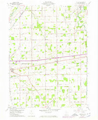
1960 Map of Moulton
USGS Topo · Published 1974About this map
The Miami and Erie Canal (Abandoned) cuts through this corner of Auglaize County, tracing the legacy of 19th-century water transport alongside modern rail and highway developments. While the canal is noted as abandoned, specific infrastructure remains visible, such as Lock Fourteen near the town of St Marys. The landscape is a structured grid of agricultural tracts defined by the Old Indian Treaty Boundary, which slants across the eastern portion of the township near Buckland.
Find a feature on this map
69 named features on this map. Tap any name to fly to it.
Don’t see what you’re looking for? This feature index may not catch every label — zoom into the map to look around manually.
Map Details
Editions of this 1960 Moulton Map
Other maps of this area

1906 · Lima
USGS Topo · 1:62,500

1909 · Loramie
USGS Topo · 1:62,500

1911 · Loramie
USGS Topo · 1:62,500

1911 · Spencerville
USGS Topo · 1:62,500

1913 · Sidney
USGS Topo · 1:62,500

1944 · Sidney
USGS Topo · 1:62,500

1944 · Loramie
USGS Topo · 1:62,500

1944 · Spencerville
USGS Topo · 1:62,500

1953 · Muncie
USGS Topo · 1:250,000

1956 · Muncie
USGS Topo · 1:250,000