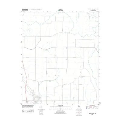
2012 Map of Mound Bayou
USGS Topo · Published 2012About this map
The settlement of Mound Bayou anchors the southwestern corner of this Bolivar County landscape, which is defined by an intricate network of waterways and agricultural section roads. The Hushpuckena River meanders across the northern boundary, while the Big Sunflower River winds through the eastern reaches, joined by tributary systems like Pecan Bayou and Beaver Bayou. This 2012 survey illustrates the intersection of traditional Delta topography with modern infrastructure, including Hwy 61 and its predecessor, Old Highway 61. Local family and community landmarks are preserved in the locations of German Lane Cem, New Hope Cem, and Zion Cem, which are situated along rural routes such as Moody Rd and Dorothy Rd. The map also reveals the persistent significance of the 16 Section Rd and 16th Section Rd markers, reflecting the enduring township-and-range surveying system of the Mississippi Delta.
Find a feature on this map
73 named features on this map. Tap any name to fly to it.
Don’t see what you’re looking for? This feature index may not catch every label — zoom into the map to look around manually.
Map Details
Editions of this 2012 Mound Bayou Map
This is the sole edition of this map. No revisions or reprints were ever made.
Other maps of this area

1930 · Mellwood
USGS Topo · 1:62,500

1931 · Drew
USGS Topo · 1:48,000

1935 · Clarksdale
USGS Topo · 1:62,500

1935 · Mound Bayou
USGS Topo · 1:62,500

1939 · Pace
USGS Topo · 1:62,500

1939 · Clarksdale
USGS Topo · 1:62,500

1939 · Mellwood
USGS Topo · 1:62,500

1948 · Helena
USGS Topo · 1:250,000

1950 · Helena
USGS Topo · 1:250,000

1953 · Greenwood
USGS Topo · 1:250,000