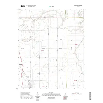
2018 Map of Mound Bayou
USGS Topo · Published 2018About this map
Mound Bayou and Winstonville anchor this portion of the Mississippi Delta, a landscape defined by an intricate network of waterways and precisely gridded agricultural sections. The area is threaded by the Hushpuckena River to the north and the Big Sunflower River along the eastern boundary, while smaller channels like Little Mound Bayou and Beaver Bayou weave through the central farmlands. These bayous historically dictated the placement of settlements and transport routes, reflected here in the dense grid of rural roads like Old Mound Bayou Rd and Sixteenth Section Rd. For local historians and genealogists, the map preserves the locations of vital community landmarks, including Zion Cem, New Hope Cem, and German Lane Cem, situated alongside family-named roads and ranch lands that mark the persistent agricultural character of Bolivar County.
Find a feature on this map
65 named features on this map. Tap any name to fly to it.
Don’t see what you’re looking for? This feature index may not catch every label — zoom into the map to look around manually.
Map Details
Editions of this 2018 Mound Bayou Map
This is the sole edition of this map. No revisions or reprints were ever made.
Other maps of this area

1930 · Mellwood
USGS Topo · 1:62,500

1931 · Drew
USGS Topo · 1:48,000

1935 · Clarksdale
USGS Topo · 1:62,500

1935 · Mound Bayou
USGS Topo · 1:62,500

1939 · Pace
USGS Topo · 1:62,500

1939 · Clarksdale
USGS Topo · 1:62,500

1939 · Mellwood
USGS Topo · 1:62,500

1948 · Helena
USGS Topo · 1:250,000

1950 · Helena
USGS Topo · 1:250,000

1953 · Greenwood
USGS Topo · 1:250,000