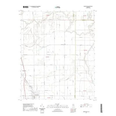
2020 Map of Mound Bayou
USGS Topo · Published 2020About this map
Mound Bayou and Winstonville anchor this portion of the Mississippi Delta, defined by a dense network of drainage canals and meandering waterways. The landscape is structured by the winding course of the Hushpuckena River to the north and the Big Sunflower River to the east, with Beaver Bayou and Little Mound Bayou threading through the agricultural plains. This survey captures the rural character of the region, where numerous family and community cemeteries such as Zion Cem, New Hope Cem, and German Lane Cem are located at the intersections of local roads like Parchman Rd and Sixteenth Section Rd. The area's hydrology is further detailed by features like Goose Lake and Hyde Bayou, illustrating the complex water management systems essential to the Delta's geography.
Find a feature on this map
75 named features on this map. Tap any name to fly to it.
Don’t see what you’re looking for? This feature index may not catch every label — zoom into the map to look around manually.
Map Details
Editions of this 2020 Mound Bayou Map
This is the sole edition of this map. No revisions or reprints were ever made.
Other maps of this area

1930 · Mellwood
USGS Topo · 1:62,500

1931 · Drew
USGS Topo · 1:48,000

1935 · Clarksdale
USGS Topo · 1:62,500

1935 · Mound Bayou
USGS Topo · 1:62,500

1939 · Pace
USGS Topo · 1:62,500

1939 · Clarksdale
USGS Topo · 1:62,500

1939 · Mellwood
USGS Topo · 1:62,500

1948 · Helena
USGS Topo · 1:250,000

1950 · Helena
USGS Topo · 1:250,000

1953 · Greenwood
USGS Topo · 1:250,000