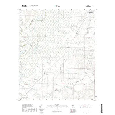
2020 Map of Moundville West
USGS Topo · Published 2020About this map
The winding Black Warrior River corridor defines the western edge of this 2020 landscape, where the boundary between Greene and Hale Counties weaves through a network of bars and shoals. Navigation landmarks such as Battlekin Bar, Washington Bar, and Cleveland Shoals highlight the historical importance of the river, while the presence of Whites Bluff and Mays Point mark the elevated terrain overlooking the bottomlands. The interior is characterized by expansive wetlands and water bodies like Little Keaton Lake and Stovers Lake, reflecting a low-lying topography that has historically influenced settlement patterns.
Find a feature on this map
82 named features on this map. Tap any name to fly to it.
Don’t see what you’re looking for? This feature index may not catch every label — zoom into the map to look around manually.
Map Details
Editions of this 2020 Moundville West Map
This is the sole edition of this map. No revisions or reprints were ever made.
Other maps of this area

1924 · Tuscaloosa
USGS Topo · 1:62,500

1926 · Tuscaloosa
USGS Topo · 1:62,500

1927 · Eutaw
USGS Topo · 1:48,000

1931 · Eutaw
USGS Topo · 1:62,500

1953 · Montgomery
USGS Topo · 1:250,000

1953 · Birmingham
USGS Topo · 1:250,000

1956 · Birmingham
USGS Topo · 1:250,000

1956 · Montgomery
USGS Topo · 1:250,000

1957 · Birmingham
USGS Topo · 1:250,000

1957 · Montgomery
USGS Topo · 1:250,000