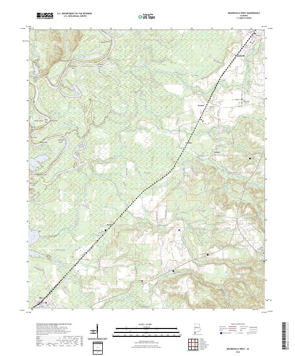
2024 Map of Moundville West
USGS Topo · Published 2024About this map
The Black Warrior River carves a winding path through the borderlands of Greene Co and Hale Co, defining a landscape marked by numerous river features including Whites Island, Cleveland Shoals, and several named bars like Washington Bar and Bohannons Bar. This 2024 survey documents the rural character of the region, anchored by the town of Moundville in the northeast and Akron in the southwest. The distribution of small settlements like Powers, Cypress, Guinea, and Stewart suggests a legacy of agricultural communities connected by a network of county roads.
Find a feature on this map
95 named features on this map. Tap any name to fly to it.
Don’t see what you’re looking for? This feature index may not catch every label — zoom into the map to look around manually.
Map Details
Editions of this 2024 Moundville West Map
This is the sole edition of this map. No revisions or reprints were ever made.
Other maps of this area

1924 · Tuscaloosa
USGS Topo · 1:62,500

1926 · Tuscaloosa
USGS Topo · 1:62,500

1927 · Eutaw
USGS Topo · 1:48,000

1931 · Eutaw
USGS Topo · 1:62,500

1953 · Montgomery
USGS Topo · 1:250,000

1953 · Birmingham
USGS Topo · 1:250,000

1956 · Birmingham
USGS Topo · 1:250,000

1956 · Montgomery
USGS Topo · 1:250,000

1957 · Birmingham
USGS Topo · 1:250,000

1957 · Montgomery
USGS Topo · 1:250,000