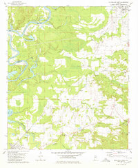
1980 Map of Moundville West
USGS Topo · Published 1980About this map
The Black Warrior River carves a winding path through the borderlands of Greene and Hale counties, leaving a landscape defined by oxbow features like Cypress Cutoff Lake and Keaton Lake. This 1980 survey shows a rural Alabama landscape where small community centers are anchored by numerous country churches, including Taylor Chapel, Glen Hill Ch, and Jerusalem Ch. The Southern Railway line provides a clear industrial axis, passing through the town of Akron and the settlement of Stewart at the southern edge of the sheet. Extensive extraction sites, marked as Gravel Pits and Sandpits, cluster near the rail lines and river, reflecting the local economy's reliance on these raw materials. From the larger town of Moundville in the northeast to the low-lying wetlands of Cypress, the map documents the persistent settlement patterns of the Alabama Black Belt.
Find a feature on this map
37 named features on this map. Tap any name to fly to it.
Don’t see what you’re looking for? This feature index may not catch every label — zoom into the map to look around manually.
Map Details
Editions of this 1980 Moundville West Map
This is the sole edition of this map. No revisions or reprints were ever made.
Other maps of this area

1924 · Tuscaloosa
USGS Topo · 1:62,500

1926 · Tuscaloosa
USGS Topo · 1:62,500

1927 · Eutaw
USGS Topo · 1:48,000

1931 · Eutaw
USGS Topo · 1:62,500

1953 · Montgomery
USGS Topo · 1:250,000

1953 · Birmingham
USGS Topo · 1:250,000

1956 · Birmingham
USGS Topo · 1:250,000

1956 · Montgomery
USGS Topo · 1:250,000

1957 · Birmingham
USGS Topo · 1:250,000

1957 · Montgomery
USGS Topo · 1:250,000