
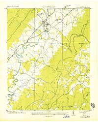
1935 Map of Mount Airy
USGS Topo · Published 1935About this map
The Sequatchie Valley and the steep slopes of the Cumberland Plateau dominate this 1935 land survey, revealing a landscape defined by its river and rail corridors. The Sequatchie River meanders through the central basin, crossed by several historic crossings including Stephen Chapel Ford and Standifer Bridge. The presence of the Nashville and St Louis Railway and the Alvin C York Highway running parallel to the river underscores the importance of this valley as a primary north-south transit route through East Tennessee.
Find a feature on this map
56 named features on this map. Tap any name to fly to it.
Don’t see what you’re looking for? This feature index may not catch every label — zoom into the map to look around manually.
Map Details
Editions of this 1935 Mount Airy Map
This is the sole edition of this map. No revisions or reprints were ever made.
Other maps of this area

1888 · Chattanooga
USGS Topo · 1:125,000

1892 · Pikeville
USGS Topo · 1:125,000

1893 · Chattanooga
USGS Topo · 1:125,000

1895 · Pikeville
USGS Topo · 1:125,000

1909 · Sequatchie Valley
USGS Topo · 1:62,500

1910 · Pikeville
USGS Topo · 1:62,500

1935 · Soddy
USGS Topo · 1:24,000

1935 · Brockdell
USGS Topo · 1:24,000

1935 · Brayton
USGS Topo · 1:24,000
1935 · Pikeville
USGS Topo · 1:24,000