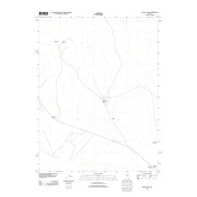
2011 Map of Mount Airy
USGS Topo · Published 2011About this map
Newpass and its surrounding desert terrain reflect a landscape shaped by mining access and isolated homesteads. The presence of the Newpass Post Office suggests a concentrated point of activity for local ranching and mining operations, while the namesake Petersons Mill and the Petersons Mill Hot Spring highlight the critical role of water and processing infrastructure in this arid environment. The map details a network of springs, including Indian Spring, Iron Tank Spring, and Barrel Spring, which provided essential resources for those navigating the routes through New Pass Summit. To the southeast, the topography rises toward Mount Airy Mesa and Mount Airy Summit, marking the high ground of the Mount Airy range. Transportation is defined by a primary arterial route and the specialized New Pass Mine Rd, illustrating the intersection of regional travel and industrial transit.
Find a feature on this map
13 named features on this map. Tap any name to fly to it.
Don’t see what you’re looking for? This feature index may not catch every label — zoom into the map to look around manually.
Map Details
Editions of this 2011 Mount Airy Map
This is the sole edition of this map. No revisions or reprints were ever made.
Other maps of this area

1955 · Millett
USGS Topo · 1:250,000

1959 · Millett
USGS Topo · 1:250,000

1966 · Edwards Creek Valley
USGS Topo · 1:62,500

1969 · Mount Airy
USGS Topo · 1:24,000

1969 · Mount Airy NW
USGS Topo · 1:24,000

1969 · Mount Airy NE
USGS Topo · 1:24,000

1969 · Gandolfo Canyon
USGS Topo · 1:24,000

1969 · Mount Airy Mesa
USGS Topo · 1:24,000

1969 · Emigrant Peak
USGS Topo · 1:24,000

1969 · Carroll Summit NE
USGS Topo · 1:24,000