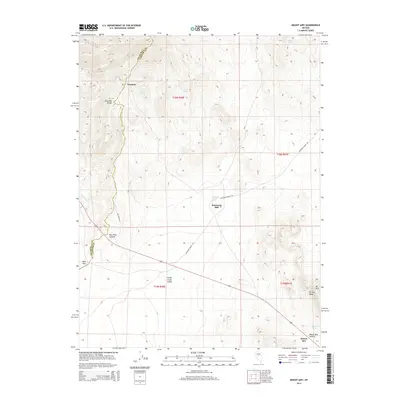
2014 Map of Mount Airy
USGS Topo · Published 2014About this map
New Pass Range defines the high ground along the Churchill County and Lander County line in this 2014 survey. This portion of the Great Basin landscape highlights the sparse but vital water sources essential for survival in the arid interior, such as Mt Airy Spring, Barrel Spring, and the Petersons Mill Hot Spring. The presence of Petersons Mill and the settlement at Newpass indicates the area's history of small-scale industry and transit, centered around the New Pass Summit crossing. Modern infrastructure like Antelope Valley Rd and Pass Miner Rd follows the natural contours of the land, connecting the high Mt Airy Mesa to the lower expanses of the Smith Creek Valley. This map documents a region where elevation and isolated springs have dictated the pattern of human presence for decades.
Find a feature on this map
22 named features on this map. Tap any name to fly to it.
Don’t see what you’re looking for? This feature index may not catch every label — zoom into the map to look around manually.
Map Details
Editions of this 2014 Mount Airy Map
This is the sole edition of this map. No revisions or reprints were ever made.
Other maps of this area

1955 · Millett
USGS Topo · 1:250,000

1959 · Millett
USGS Topo · 1:250,000

1966 · Edwards Creek Valley
USGS Topo · 1:62,500

1969 · Mount Airy
USGS Topo · 1:24,000

1969 · Mount Airy NW
USGS Topo · 1:24,000

1969 · Mount Airy NE
USGS Topo · 1:24,000

1969 · Gandolfo Canyon
USGS Topo · 1:24,000

1969 · Mount Airy Mesa
USGS Topo · 1:24,000

1969 · Emigrant Peak
USGS Topo · 1:24,000

1969 · Carroll Summit NE
USGS Topo · 1:24,000